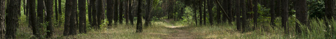


Shenandoah National Park is located in the Blue Ridge Mountains of Virginia just west of Washington, D.C. and stretches 105 miles from its northern entrance at Front Royal to its southern entrance near Waynesboro. Click Here to see a map of the entire area which shows all entrances, including the little used, Swift Run Gap Entrance which is an additional Central entrance that is better for some people depending on where they are coming from.
Accessible via I-66 and Route 340. Northern District: Front Royal to Thornton Gap and Covers Skyline Drive mile 0 to mile 31.5. Click here for a map of the north area of Skyline Drive and Shenandoah National Park that shows all of the hikes in this area so you can decide which entrance you wish to use to get to this hike. See the next section on this page for customized driving directions to this area once you decide which entrance you would like to use for getting there.
Accessible via Route 211. Central District: Thornton Gap to Swift Run Gap and covers Skyline Drive mile 31.5 to mile 65.5 Click Here for a map of the Central District area of Skyline Drive and Shenandoah National Park that shows all of the hikes in this area so you can decide which entrance you wish to use to get to this hike. See the next section on this page for customized driving directions to this area once you decide which entrance you would like to use for getting there.
Accessible via Route 33 accessible via Route 211. Alternate Central District Access: Swift Run Gap puts you on the drive at mile 65.5 Click Here for a map of the Central District area of Skyline Drive and Shenandoah National Park that shows all of the hikes in this area so you can decide which entrance you wish to use to get to this hike. See the next section on this page for customized driving directions to this area once you decide which entrance you would like to use for getting there.
Accessible via I-64 and Route 250 (South District: Swift Run Gap to Rockfish Gap (Skyline Drive mile 65.5 to mile 104.6) Rockfish Gap is also the northern entrance to the Blue Ridge Parkway. Click Here for a map of the Southern District area of Skyline Drive and Shenandoah National Park that shows all of the hikes in this area so you can decide which entrance you wish to use to get to this hike. See the next section on this page for customized driving directions to this area once you decide which entrance you would like to use for getting there.
While our hike directions assume you are looking for the quickest way to reach the trailhead I am VERY often contacted by members asking if there is another way to enter the park where can enjoy a leisure drive to and from where they are hiking. Take note that no matter where you enter the park, there are over 70 pull overs and they all allow you to turn around and head either direction so you are not stuck on a one way road, yay! So, your choice of how to get to the hike does not limit any driving and enjoying or the overlooks after your hike if you want to take in some fantastic sights!
Depending on How Much Driving You Wish to Enjoy Along Skyline Drive , You Can Use the Northern Entrance (near Front Royal), the Central District Entrance (near Sperryville), or the Southern Entrance (near Waynesboro)
To North Entrance - Travel west on Interstate 66 to Front Royal, Virginia (62 miles). Take exit onto Route 340 South and follow signs for Shenandoah National Park and Skyline Drive. For customized driving directions from where you are coming from to this entrance, Click Here for Google Driving Directions.
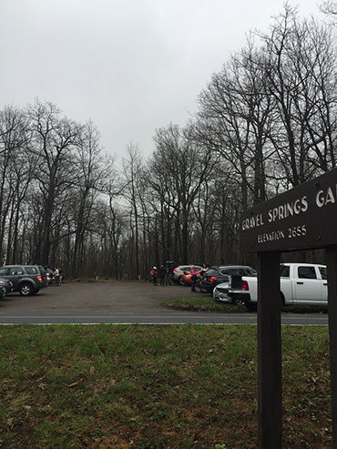
To Thornton Gap Entrance (Thornton Gap: 38.660959, -78.320761) - Travel west on Interstate 66 to exit 43A (32 miles). Take US Highway 29 South to Warrenton, Virginia (11 miles). Take US Highway 211 West to Shenandoah National Park and Skyline Drive (28 miles). For customized driving directions from where you are coming from to this entrance, Click Here for Google Driving Directions!
To Southern Rockfish Entrance - Travel west on Interstate 64 to exit 99 (87 miles) and follow signs to Shenandoah National Park and Skyline Drive. For customized driving directions from where you are coming from to this entrance, Click Here for Google Driving Directions!
To Swift Run Gap Entrance - Travel west on Interstate 64 to Charlottesville, Virginia (65 miles). Take exit to US Highway 29 North (14 miles). Turn left onto US Highway 33 West and follow 14 miles to Shenandoah National Park and Skyline Drive. For customized driving directions from where you are coming from, to this entrance, Click Here for Google Driving Directions!
To North Entrance - Travel east on Interstate 76 to exit 161 (105 miles). Take Interstate 70 East to US Highway 522 South (25 miles). Follow 522 to VA-37 South (24 miles) to Interstate 81 South (7 miles). Follow I-81 South 9.5 miles to Interstate 66 East. Take I-66 to Front Royal, Virginia (7 miles). Follow signs to Shenandoah National Park and Skyline Drive. For customized driving directions from where you are coming from, to this entrance, Click Here for Google Driving Directions!


